3D

Products

Not all data is created equal. Digital Elevation Models (DEM) and advanced 3D visualisations answer crucial questions, provide unique insights and give decision makers the data they require for success. Through partnerships with world leading geospatial services companies, we offer the world’s highest quality optical satellite-based 3D products and solutions.

Explore The surface

Rapid Production

For time sensitive projects in need of actionable data

Global
Coverage

Fresh elevation data no matter where in the world

Guaranteed Accuracy

Resolution and precision for superior analysis

RapidDem

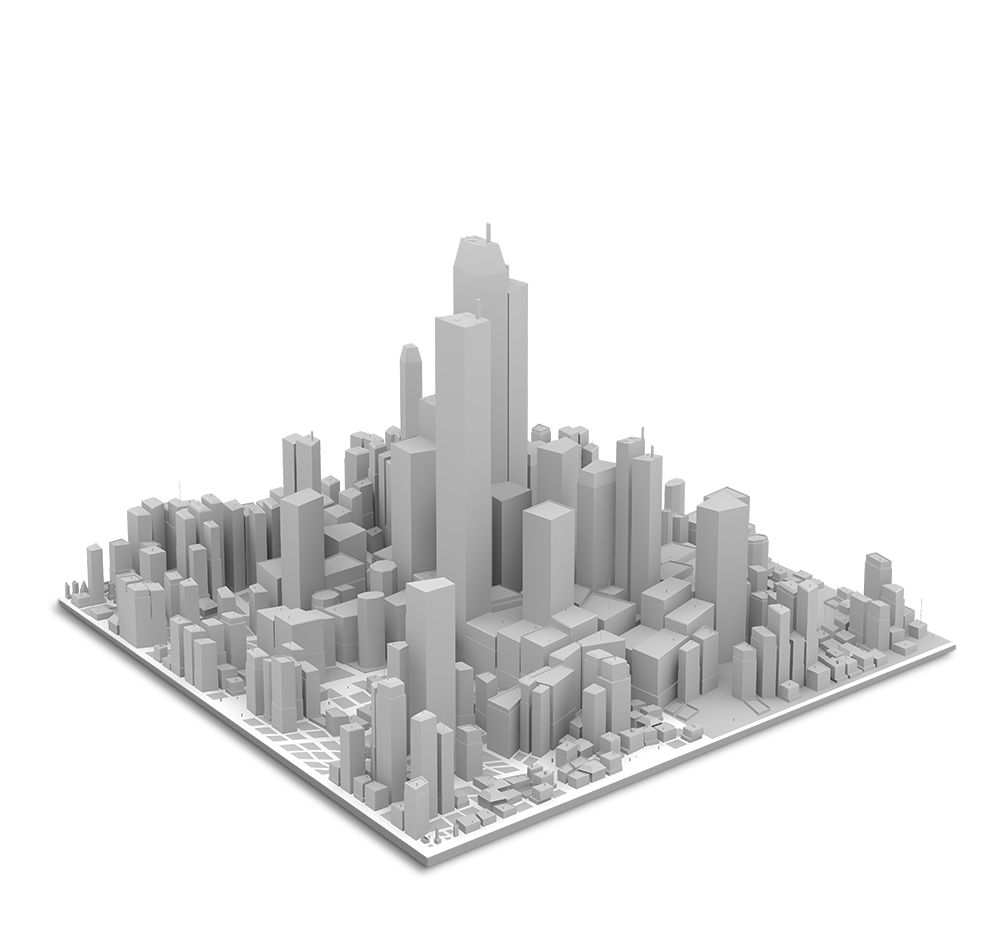
European Space Imaging has partnered with GAF AG to offer this revolutionary elevation product. With RapidDEM, users can get fresh Very High Resolution (VHR) Digital Elevation Models (DEM) delivered 24 hours after collection.

Utilizing a sophisticated method whereby five VHR stereoscopic images are collected from varying angles on a single satellite pass, European Space Imaging is able to provide incredibly accurate elevation data and the highest quality 30 cm resolution textures to GAF AG, who then builds the 3D model and rush delivers it to the end user.

Lisbon RapidDEM

GAF Elevation Suite

GAF offers users a wide range of Digital Terrain Models (DTM), Digital Surface Models (DSM) and 3D visualisations at unparalleled accuracy. 

Available products include:

  • Tri-Stereo DSM – 30 – 50 cm 3D for specific spots worldwide
  • Euro-Maps 3D – countrywide, precise and cost-efficient
  • Bathymetry from space
  • Custom Solutions
GAF DEM

AW3D
By NTT Data

AW3D is the world’s first and the most precise 3D map covering all global land spaces with 5 meter resolution plus 50 cm resolution 3D models on demand. 

Available products include:

  • AW3D Standard – DSM / DTM
      • 2.5 m / 5 m Resolution
  • AW3D Enhanced – DSM / DTM
      • 0.5 m / 1 m / 2 m Resolution
AW3D DEM

Maxar 3D Data Suite

Maxar’s technology enables imagery content to accurately represent all visible objects on the earth in 3D, and the products provide customers with unmatched value and utility, superior coverage relative to aerial-derived elevation models, and superior fidelity and availability relative to other satellite-derived models.

Available products include:

  • DSM – Global 50 cm surface model with high accuracy
  • DSM 10 – medium resolution surface model
  • True Ortho – orthorectified imagery without parallax or occlusion
  • 3D Surface Model – 50 cm 3D visualisation 
Vricon DEM

Don't See What You're Looking For?

Let’s discuss a custom solution for your project.